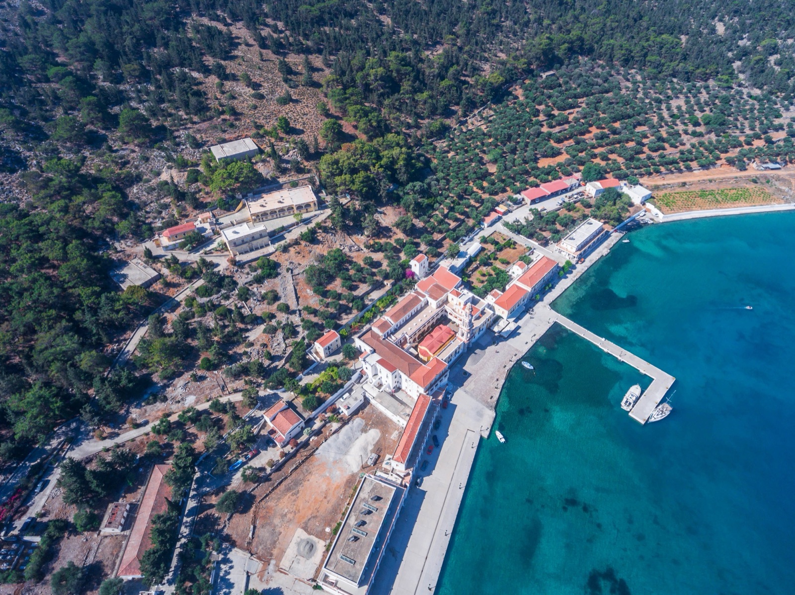
Hiking on Symi: Trails, Walking Times and the Paths to Nanou, Agia Marina and Lapathos
Symi is one of the best small islands in the Dodecanese for walking, and you can hike it without a guide. Most of the trails are short, from a 20-minute coastal path at Pedi to a walk of about an hour and three-quarters from the windmills above Horio down to Agia Marina. The longer routes cross the bare, high middle of the island to remote bays such as Nanou and Lapathos. The paths are rough and stony, marked with paint on the rocks, and in summer the heat matters more than the distance. Walk early, carry plenty of water, and plan your way back before you set off.
This guide covers the island’s waymarked trails with their distances and walking times, the longer routes over the central ridge, how the paths are marked, when to go, what to carry, and how to combine a walk with a taxi-boat or a bus.
Symi’s trails at a glance
| Trail | Distance | Time | Character |
|---|---|---|---|
| Pedi to Agios Nikolaos beach | 1 km | about 20 min | Easy coastal path, dense waymarking |
| Horio to the Dragon’s Fort | 1.2 km | about 25 min | Short path to an ancient fortification |
| Gialos to Agios Fanourios | 1.5 km | about 30 min | Gentle climb past the Elikoni cemetery |
| Agios Georgios Ptochos to Lappatoni castle | 2 km | about 30 min | Level ridge path through cypresses |
| Xisos to Agios Vasilios and Lapathos | 2.1 km | about 45 min | Easy at first, very steep at the end |
| Panagia Strateri down to Nanou | 2.2 km | about 50 min | Steep descent through cypress forest |
| Mylos to Pontikokastro, Agia Marina and Pedi | 4.6 km | about 1 h 45 min | Stony hill walk with a steep descent |
These are the 7 trails described by the island’s own visitor portal, symitop.gr. The times are walking times at a steady pace, one way, and do not include swims, photographs or rests in the shade, which on Symi you will want.
What walking on Symi is like
Symi is small but steep. The island rises to 617 m, and almost every walk out of town starts with a climb. Away from the harbour the landscape is dry limestone: grey rock, low scrub and stone walls, broken by pockets of cypress and pine in the valleys and on the higher ground towards the south. Many paths follow old field boundaries and pass through gates in fenced enclosures where goats and sheep graze.
The surface is the thing to prepare for. Paths are mostly narrow, stony and uneven, with loose rock on the descents and polished stone on the old stepped tracks. Very little is shaded on the eastern and northern sides of the island. On the other hand, distances are short, the views over the sea and the Turkish coast are constant, and many walks end at a beach or a chapel.
How the paths are marked
Most trails are marked with red paint, sometimes red and blue, applied as dots, lines or blobs on the rocks. Some routes add cairns or occasional pale blue or green marks. The Agios Vasilios path starts by a wooden sign with red and blue marks at the entrance, and the coastal path from Pedi to Agios Nikolaos is densely waymarked and easy to follow.
Do not expect the marking to be complete. One widely read guide to getting around the island warns that the paths are not all well marked, often just with lines painted on stones. On the walk from Pontikokastro down to Agia Marina, the start is marked with red blobs and cairns, but stronger false trails can mislead you at first. Keep looking for the next mark before you lose the last one, and if the path seems to vanish, go back to the last mark you were sure of.
Gates and fences
Several paths cross fenced land, and the walking notes tell you which gate to open and which leads only into a neighbouring field. Close every gate behind you, keep to the path, and do not climb walls.
The short trails near town
Pedi to Agios Nikolaos beach (1 km, about 20 minutes)
This is the easiest walk on the island and the one to start with. The path begins in front of the church of Agios Thomas at the eastern edge of Pedi bay. At first it is paved with cement and follows the shore, then it climbs a little over rock, well marked with red paint, before dropping to the beach. Look back for the view of Horio at the top of the Pedi valley.
Agios Nikolaos has tamarisk trees for shade, sunbeds, umbrellas, a jetty for the boats and a taverna, so you can walk there in the morning and take the taxi-boat back if you are tired. Another set of walking notes gives 20–25 minutes for the walk. The Pedi guide covers the bay and its beaches in more detail.
Horio to the Dragon’s Fort (1.2 km, about 25 minutes)
From Gialos, follow the main road towards Panormitis to the southern end of Horio. Just before the chapel of Agia Evdokia there is a bench at a viewpoint, and the path starts on the left, paved with cement for the first few metres and marked with red paint. About 250 m along, an Archaeological Service sign reads “Ancient Dragon Fortification”. The path continues between dry-stone walls and through several gates to the entrance of the archaeological site. At one fork, the left branch leads to farmhouses behind Pedi; you want the right.
Gialos to Agios Fanourios (1.5 km, about 30 minutes)
A gentle walk from the harbour. Take the concrete road from Gialos to the cemetery of Elikoni; just before the cemetery a path turns left, marked in blue and red. It crosses a ravine and climbs smoothly past a stable and through three wooden gates, then follows an iron water pipe on a cobbled base to the chapel of Agios Fanourios.
The Mylos to Agia Marina and Pedi walk (4.6 km, about 1 hour 45 minutes)
This is the most rewarding half-day walk close to town, and a good introduction to the island’s bare interior. It starts at Mylos, the area of windmills on the main road east of Horio, where the road meets the cobbled street into the village; a sign points towards Pontikokastro.
With the mills on your right, follow a smooth path to an iron gate, pass the ruined mills and reach Pontikokastro, the “mouse castle”, a prehistoric mound. From here the path climbs on the north side of the Noulia hilltop, then crosses a plateau that slopes gently for about 800 m. After that it descends steeply towards the sea, and the islet of Agia Marina with its chapel comes into view.
At the bottom, a gate leads through the beach bar and restaurant area at Agia Marina and out the other side. The path then climbs gently for a short distance to face the chapel of Agios Nikolaos across the bay, and continues clearly to Pedi. From Pedi you can take the bus back up to Horio and Gialos.
Doing it in reverse
You can walk the route from Pedi instead. The restaurant at Agia Marina is just under 30 minutes from Pedi, and the onward path from the beach to the eastern edge of Horio takes about an hour, much of it stony to very stony underfoot, through what one walker describes as a desert mountainscape. The peninsula between Pedi and Gialos bays rises to 249 m, and the path crosses its shoulder rather than its summit. There is less climbing in the reverse direction, but the start near Pontikokastro is harder to find from the top, and the final descent to Agia Marina is stony and uncomfortable.
A note of courtesy: the chapel on the islet off Agia Marina is a short swim away, and naturist sunbathing near it has caused considerable offence to local people. Keep your swimsuit on.
The walks to the remote bays
Towards Nanou (2.2 km, about 50 minutes)
Nanou is one of the island’s loveliest bays, and you can walk down to it from the road. The path starts on the Symi–Panormitis road, directly opposite the chapel of Panagia Strateri on the central ridge. Marked with red paint, it drops steeply into a ravine and immediately enters dense cypress forest. It follows the gully down, crosses it and continues on the south side, always in thick vegetation. Just before the beach, on your right, is the Skordalos cave, where traces of Neolithic habitation were found.
Other walking notes advise allowing at least 45 minutes from Panagia Strateri to the beach. The climb back up is harder: about 45 minutes or more from the beach to the ridge, tiring in hot weather, with fallen pine needles on the upper path, so wear shoes with a good grip.
The smart way to do Nanou is one way. Take the taxi-boat out from Gialos, a fast ride of about 20–30 minutes depending on stops, then walk up from the beach to the road. Or walk down and arrange to be collected by boat. Nanou has a seasonal taverna, but check that the boats are running before you rely on them.
Xisos to Agios Vasilios and Lapathos (2.1 km, about 45 minutes)
This trail leads to one of the island’s most remote beaches. Follow the cement road south from the Xisos settlement; the path starts to the left of the fence of the house at the end of the road, by a wooden sign. Keep the fence on your right, cross the gully, and follow a smooth path along the northern slope of the mountain, through clumps of cypress. As the beach comes into view, steps on your right lead up to the chapel of Agios Vasilios.
The last part to the beach is the hardest section of any of the short trails. The path becomes very steep, and you descend from rock to rock following the red and blue marks. Take it slowly, and remember you have to climb it again. Agios Vasilios has no road access and no facilities.
If you walk all the way from town rather than driving to Xisos, the same guide gives about 4.8 km and 2 hours each way, and about 12 km and 4 hours one way to Nanou. Those are long, hot days on rough ground, best left to experienced hikers in spring or autumn.
Agios Georgios Ptochos to Lappatoni castle (2 km, about 30 minutes)
A quiet walk west of Xisos. It starts in the courtyard of the chapel of Agios Georgios Ptochos, at the end of the dirt road. Through two iron gates, follow the red dots parallel to the ridge on smooth ground until you enter cypresses; the path ends at the remains of the old castle of Lappatoni.
Over the central ridge
The high middle of the island is where Symi’s walking gets serious. A long route from Horio climbs the southern wall of the Pedi valley, passes the monastery of Panagia Hamon and joins the asphalt road towards Panagia Strateri, with a detour to the hilltop monastery of Taxiarchis Mihail Kokkimidis. Allow at least 90 minutes to Strateri, plus 20–25 minutes for the detour. From Strateri you can return to Horio in 60–70 minutes via the monastery of Agios Prokopios.
This part of the island has two things to know. First, Mt Vigla, the island’s highest point, has masts in a zone where photography is not permitted, and there is a military post near where the route meets the road. Respect the signs. Second, the walk follows stretches of the old kalderimi, the island’s raised north–south stone road and the predecessor of the asphalt one, which is a highlight in itself.
The Byzantine wine presses
From Panagia Strateri, a walk of 50 minutes or more leads south to Kourkouniotis and a group of stone wine presses, carved or built from the limestone, which a sign dates to the 10th–17th centuries. About 130 such presses have been found on Symi; wine was a major export until production ended in the early 19th century. The eleven presses at Kourkouniotis have been restored. Above them, a less clear path leads to a clifftop with views south to Panormitis bay and its monastery.
Some monasteries on these routes are kept locked; the walking notes say Agios Nikolaos Kefali, on its remote peninsula, usually is. Treat any open chapel as a bonus, and close its door when you leave.
The stair-paths of town
Not every good walk on Symi leaves town. The Kali Strata, about 500 steps from Gialos to Horio, takes around 20–30 minutes to climb. A second, lesser-known stair-path, the Kataraktis (“waterfall”), descends around the western side of Horio’s acropolis into the back of Gialos. Its steps are much longer, so there are fewer of them; allow 15–25 minutes. Up the Kali Strata and down the Kataraktis makes a fine circuit before breakfast, and the Symi town guide explains what you pass on the way.
From Horio, the direct main road down to Pedi takes 10–15 minutes on foot, while a countryside path around the top of the valley takes about 35–45 minutes to the Pedi seafront.
When to hike on Symi
Spring and autumn are the walking seasons. HNMS averages for nearby Rhodes give an average daily maximum of 20.0 °C in April and 24.1 °C in May, and 24.5 °C in October, against 30.4 °C in July and 30.7 °C in August. On Symi’s bare slopes, with stone reflecting the heat and little shade, a summer afternoon walk is genuinely hard work. The island’s ferry operator calls walking around in August an endurance challenge, and that is in town.
In July and August, if you walk at all, start at first light and be off the exposed ground by late morning. The meltemi wind blows hardest from mid-June to early September, usually at midday and in the afternoon, and can make exposed ridges and descents unpleasant. Winter brings most of the year’s rain, from November to February, and wet limestone is slippery. Check the Symi weather page before a long walk.
What to carry
- Water. More than you think: at least a litre and a half for a short trail in warm weather, and much more for the ridge walks. There are no springs or shops on most routes.
- Proper shoes. Trail shoes or light boots with a good grip. Sandals and flip-flops are not enough on loose limestone.
- Sun protection. A hat, sunglasses and sunscreen, because shade is rare.
- Swimming things and water shoes. Many walks end at a beach, and Symi’s pebbles are coarse.
- Cash. Beach tavernas do not always accept cards, and taxi-boat and bus fares are paid in cash.
- A charged phone and an offline map. Signal can be patchy behind the ridges.
- Snacks. Several remote beaches, including Agios Vasilios and Agios Georgios Dysalona, have no facilities at all.
Combining walks with boats and buses
Symi’s transport makes one-way walks easy. The minibus runs from Gialos up to Horio and down to Pedi; buses normally leave Gialos on the hour from 8am and return from Pedi at half past, with no service at 3pm. Taxi-boats leave Gialos hourly until lunchtime for the east coast beaches and return in the afternoon, and a smaller boat from Pedi runs to Agios Nikolaos and Agia Marina whenever there are enough passengers. Taxi-boats normally run only between May and mid-October.
Some good combinations:
- Pedi to Agios Nikolaos and back by boat. The bus to Pedi, the coastal path, a swim, and a 5-minute boat ride back.
- Mylos to Agia Marina to Pedi. Walk from Horio and catch the bus from Pedi.
- Nanou by boat, up on foot. A taxi-boat to Nanou, a swim, then the climb to Panagia Strateri, if someone can collect you at the road.
The guide to getting around Symi covers the bus, taxis, boats and rentals in full.
Safety on Symi’s paths
Symi’s trails are not dangerous if you treat them with respect, but they are remote. On most routes you will meet nobody, and mobile signal can drop out in the valleys. Tell someone at your accommodation where you are going and when you expect to be back. Turn round if the marking disappears and you are no longer sure of the way.
Heat is the main risk. Dehydration and heat exhaustion arrive faster than you expect on bare rock; if you feel dizzy or stop sweating, get into shade, drink and rest. Take the steep descents slowly, especially the last section to Lapathos and the rocky drop to Agia Marina, where a twisted ankle is the classic injury. Watch for goats dislodging stones above you. Never rely on a boat collection that has not been confirmed with the skipper.
Walking on a day trip from Rhodes
If you are on Symi for a few hours from Rhodes, a true hike will not fit. Day trips typically give 3–5 hours of free time, and you need to be back at the harbour before the boat leaves. What does fit is the Kali Strata up to Horio and the Kataraktis down, or the walk round the harbour to Nos beach, about 20 minutes on the flat from the bus station. A day trip that includes Panormitis gives you a short walk around the monastery and its cove instead. To hike properly, stay at least two nights; the where to stay on Symi guide explains the options.
Boat trips from Rhodes are on the tours page, and the getting to Symi guide covers the regular ferries if you want to come for longer.
Respecting the island
- Stay on the path and close gates.
- Carry all your rubbish out, including fruit peel.
- Dress respectfully if you enter a chapel or monastery: shoulders and knees covered.
- Do not light fires or barbecues; the pine and cypress woods burn easily in summer.
- Do not move cairns or add paint marks of your own.
- Do not photograph the military zones on the high ground.
Frequently asked questions
Is Symi good for hiking?
Yes. The island has a network of old paths and waymarked trails, from a 1 km coastal walk at Pedi to long routes over the central ridge to Nanou and Lapathos. Paths are rough and stony, and the best months are spring and autumn.
What is the easiest walk on Symi?
The coastal path from Pedi to Agios Nikolaos beach: 1 km, about 20 minutes, densely waymarked, and ending at a beach with a taverna and shade.
Can you walk to Nanou beach?
Yes. A 2.2 km trail of about 50 minutes descends from the Symi–Panormitis road opposite Panagia Strateri through cypress forest. Many walkers take a taxi-boat to Nanou and walk up instead.
Are Symi’s hiking trails well marked?
Partly. Most are marked with red, or red and blue, paint on the rocks, but marking is patchy in places and false trails can mislead. Keep the last mark in sight.
When is the best time to hike on Symi?
April, May and October, when average maximums at Rhodes are about 20–25 °C. In July and August walk only at first light.